menu close
Map of Croatia during WWII

Mapping the Holocaust in the
Independent State of Croatia

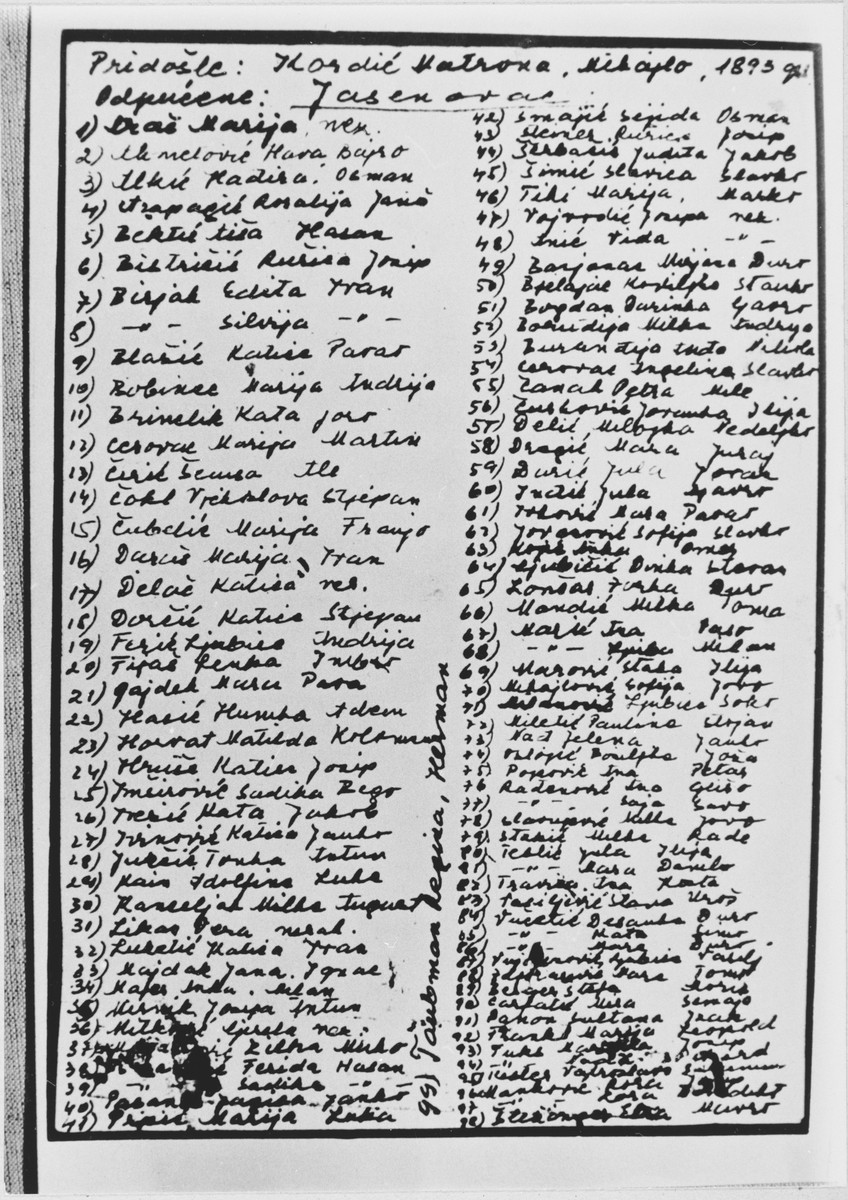
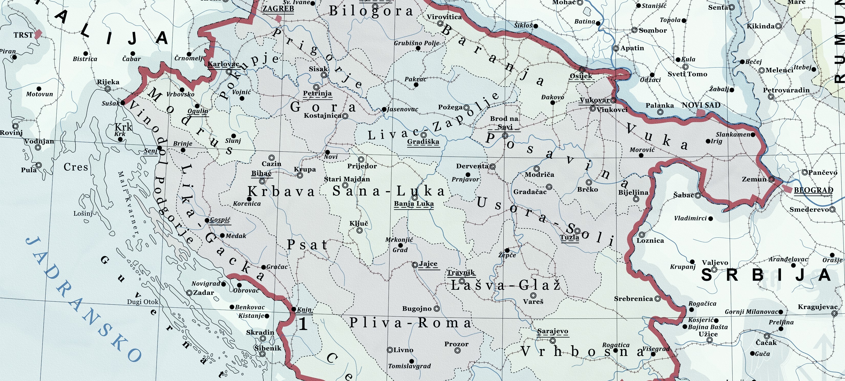
A digital tool to understand the Holocaust in the fascist Independent State of Croatia, the history of Jewish communities and postwar commemorative sites in contemporary Croatia.

Navigate through the different sites, maps and galleries to find information, primary sources such as survivors testimonies, perpetrators documents and accounts by gentile bystanders, rescuers and accomplices.

This is an ongoing project; new locations, documents, and other materials are continuously added to the platform.

Themes

Interactive Map

Navigate through the map by zooming and panning.

Click any of the highlighted locations to access their detailed information and dedicated sites.

You can always come back to the initial extent by clicking on the Home button on the top left of the map.

Use the checkboxes below to filter the map locations by their type.

The Area Today

Note: The highlighted locations are not interactive while the Swipe option is activated

Activate the Swipe button to be able to compare the Independent State of Croatia Holocaust locations and a contemporary map

flip horizontal Swipe

Note: The highlighted locations are not interactive while the Swipe option is activated

Sponsors

With Assistance from the Conference on Jewish Material Claims Against Germany.
Supported by the German Federal Ministry of Finance.